|
Thumbnail |
Title |
Category |
Data Source |
Resource |
|
 |
Head of the Mountain State Nature Preserve (ND) |
Cadastre |
ND Parks and Recreation Department |
|
|
Abstract:
The boundary of the Head of the Mountain State Nature Preserve.
Metadata File
Data last updated: 2011-09-21
|
|
 |
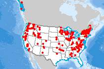
High Frequency Radar Locations |
Communications |
National Oceanic and Atmospheric Administration |
|
|
Abstract:
This dataset show the point locations of High Frequency (HF) radar systems across the US.
Metadata File
Publication Date: February 2016 -
Data last updated: 2017-01-06
|
|
 |
High Irreplaceability Area |
Ecology |
Two Countries, One Forest |
|
|
Abstract:
This layer displays areas of land that have been assessed for conservation irreplaceability, current threat of human land transformation, and three possible scenarios for the future of land transformation associated with different growth scenarios.
Metadata File
Publication Date: November 2007 -
Data last updated: 2013-01-09
|
|
 |
Highest Ranked Wildlife Habitat (NH) |
Ecology |
NH Fish and Game Department - Wildlife Division |
|
|
Abstract:
Relative rank of wildlife habitat by ecological condition within the state of New Hampshire.
Metadata File
Publication Date: March 2010 -
Data last updated: 2011-09-21
|
|
 |
Historic Area Feature - National Register of Historic Places |
Land Status |
National Park Service |
|
|
Abstract:
Depicts properties listed on the National Register of Historic Places and depicted as areas.
Metadata File
Publication Date: March 2023 -
Data last updated: 2023-11-28
|
|
 |
Historic Point Feature - National Register of Historic Places |
Land Status |
National Park Service |
|
|
Abstract:
Depicts properties listed on the National Register of Historic Places and depicted as points.
Metadata File
Publication Date: March 2023 -
Data last updated: 2023-11-28
|
|
 |
Hospital |
Buildings |
Geological Survey - GNIS |
|
|
Abstract:
This layer shows the location of Hospitals in the United States.
Metadata File
Publication Date: December 2016 -
Data last updated: 2017-02-01
|
|
 |
Household Transportation Energy Burden |
Demographics |
Argonne National Laboratory |
|
|
Abstract:
Depicts census-tract-level estimates of household transportation energy affordability in terms of the transportation energy burden, defined as the percentage of annual household income spent on the household vehicle fuel costs.
Metadata File
Publication Date: December 2020 -
Data last updated: 2021-06-04
|
|
 |
Households without Vehicles |
Demographics |
Census Bureau - American Community Survey |
|
|
Abstract:
Depicts household without vehicle statistics by census tract, including rented/owned statistics, for the U.S.
based on the 2019 American Community Survey (5-Year) data.
Metadata File
Publication Date: January 2019 -
Data last updated: 2021-10-08
|
|
 |
Housing - Mobile Home Units/sq. mi. |
Demographics |
Census Bureau - American Community Survey |
|
|
Abstract:
Block-group-level estimates multi-unit housing and mobile home statistics, including rented/owned statistics for the U.S. based on the 2018 American Community Survey (5- Year) data.
Metadata File
Publication Date: January 2018 -
Data last updated: 2021-07-26
|
|
 |
Housing - Units in Large Multi-unit Structures/sq. mi |
Demographics |
Census Bureau - American Community Survey |
|
|
Abstract:
Block-group-level estimates multi-unit housing and mobile home statistics, including rented/owned statistics for the U.S. based on the 2018 American Community Survey (5- Year) data.
Metadata File
Publication Date: January 2018 -
Data last updated: 2021-07-26
|
|
 |
Human Footprint (Northern Appalachian/Acadian Ecoregion) |
Ecology |
Wildlife Conservation Society Canada |
|
|
Abstract:
This layer displays the extent and relative intensity of human influence (or impact) on the lands surface in the Northern Appalachian/Acadian Ecoregion at a resolution of 90m for landuse and conservation planning purposes.
Metadata File
Publication Date: November 2007 -
Data last updated: 2012-06-01
|
|
 |
Hydro Run of River Max Monthly Generation (1970 - 2015, May) |
Hydrography |
Argonne National Laboratory |
Water |
|
Abstract:
Depicts run-of-river (ROR) hydroelectric power plant sites in the U.S., attributed with descriptive information, and minimum and maximum power generation by month of year between 1970 and 2015. Symbolization shows the maximum monthly generation occurring between 1970 and 2015 in the month of May, which is the month with the highest overall generation.
Metadata File
Publication Date: December 2016 -
Data last updated: 2016-12-22
|
|
 |
Hydro Run of River Min Monthly Generation (1970 - 2015, September) |
Hydrography |
Argonne National Laboratory |
Water |
|
Abstract:
Depicts run-of-river (ROR) hydroelectric power plant sites in the U.S., attributed with descriptive information, and minimum and maximum power generation by month of year between 1970 and 2015. Symbolization shows the minimum monthly generation occurring between 1970 and 2015 in the month of September, which is the month with the lowest overall generation.
Metadata File
Publication Date: December 2016 -
Data last updated: 2016-12-22
|
|
 |
HydroKinetic Project |
Hydrography |
Federal Energy Regulatory Commission |
|
|
Abstract:
Hydrokinetic Projects with Licenses and Preliminary Permits
Metadata File
Publication Date: December 2016 -
Data last updated: 2017-01-06
|


