|
Thumbnail |
Title |
Category |
Data Source |
Resource |
|
 |
Paint Creek Focus Area (OH) |
Ecology |
OH Department of Natural Resources - Division of Wildlife |
|
|
Abstract:
This layer displays areas in the Paint Creek Grassland that can support grassland habitats in a conservation effort aimed at abundant species and those that are at risk.
Metadata File
Data last updated: 2011-09-21
|
|
 |
Tecumseh Focus Area (OH) |
Ecology |
OH Department of Natural Resources - Division of Wildlife |
|
|
Abstract:
This layer displays areas in the Tecumseh Forestland that can support forest habitats in a conservation effort aimed at abundant species and those that are at risk.
Metadata File
Data last updated: 2011-09-21
|
|
 |
Killbuck Focus Area (OH) |
Ecology |
OH Department of Natural Resources - Division of Wildlife |
|
|
Abstract:
This layer displays areas in the Killbuck Wetland that can support wetland habitats in a conservation effort aimed at abundant species and those that are at risk.
Metadata File
Data last updated: 2011-09-21
|
|
 |
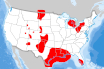
Domal Salt Formation |
Geology |
Oak Ridge National Laboratory |
Storage |
|
Abstract:
The geographic location of possible domal salt formations in the United States.
Metadata File
Data last updated: 2013-02-01
|
|
 |
Petrochemical Facility |
Utilities |
Oak Ridge National Laboratory |
|
|
Abstract:
This layer displays petrochemical facilities that would conceivably use the process steam from a high-temperature gas-cooled reactor (HTGR) – 700-750 C reactor outlet temperature to produce steam at 400-550 C for oil refinery distillation and chemical processing activities in the United States.
Metadata File
Publication Date: December 2011 -
Data last updated: 2012-06-05
|
|
 |
North American Electricity and Environment Model (NEEM) Regions |
Boundary |
Oak Ridge National Laboratory |
|
|
Abstract:
This layer represents North American Electricity and Environment (NEEM) regions in the United States. It is based on a model and drawing from Charles Rivers Associates and Oak Ridge National Laboratory respectfully, and then digitized at Argonne National Laboratory.
Metadata File
Publication Date: January 2013 -
Data last updated: 2022-06-13
|
|
 |
Onshore Oil and Natural Gas Wells |
Land Status |
Oak Ridge National Laboratory |
|
|
Abstract:
This feature class/shapefile contains Oil and Natural Gas Wells for the Homeland Infrastructure Foundation-Level (HIFLD) Database (https://gii.dhs.gov/HIFLD) as well as the Energy modeling and simulation community.
Metadata File
Publication Date: September 2019 -
Data last updated: 2020-10-21
|
|
 |
Hydropower Energy Storage Capacity |
Utilities |
Oak Ridge National Laboratory |
|
|
Abstract:
The Hydropower Energy Storage Capacity (HESC) Dataset catalogues estimates of nominal energy storage capacity based on varying levels of detail. These data provide a foundation for understanding available resources at existing hydropower facilities and their potential to provide storage of energy and more flexible generation.
Metadata File
Publication Date: 2021 -
Data last updated: 2022-03-10
|
|
 |
Energy Potential Non-Powered Dam |
Utilities |
Oak Ridge National Laboratory |
|
|
Abstract:
This layer was created to assess the energy potential at non-powered dams (NPDs) throughout the United States.
Metadata File
Publication Date: 2012 -
Data last updated: 2016-11-02
|
|
 |
Bedded Salt Formation |
Geology |
Oak Ridge National Laboratory |
|
|
Abstract:
The geographic location of possible bedded salt formations in the United States.
Metadata File
Publication Date: 2005 -
Data last updated: 2021-10-26
|
|
 |
Population Density (LandScan) |
Demographics |
Oak Ridge National Laboratory - LandScan |
|
|
Abstract:
This layer displays population distribution across the United States.
Metadata File
Publication Date: 2009 -
Data last updated: 2012-06-01
|
|
 |
NERC Subregions |
Boundary |
Oak Ridge National Laboratory; et al. |
|
|
Abstract:
Depicts North American Electric Reliability Corporation (NERC) subregions
Metadata File
Publication Date: June 2018 -
Data last updated: 2019-01-29
|
|
 |
Navigational Aid - Aircraft |
Transportation |
Our Airports.com |
|
|
Abstract:
Depicts air navigation points used by aircraft in the United States including VOR, TACAN, DME, and NDBs.
Metadata File
Publication Date: June 2018 -
Data last updated: 2019-01-30
|
|
 |
Conservation Opportunity Area (PA) |
Land Status |
PA Natural Heritage Program |
|
|
Abstract:
This layer displays Conservation Opportunity Areas (COA’s), which is an approximation of the SWAP priority conservation areas in Pennsylvania.
Metadata File
Data last updated: 2011-09-21
|
|
 |
CNHI: Core Habitat (PA) |
Ecology |
PA Natural Heritage Program - Western PA Conservancy |
|
|
Abstract:
Displays the Core Habitat of Natural Heritage Areas identified through the County Natural Heritage Inventory project of the Pennsylvania Natural Heritage Program. County Natural Heritage Inventories (CNHIs) focus on areas that are the best examples of ecological resources in a county.
Metadata File
Publication Date: December 2010 -
Data last updated: 2011-09-21
|


