|
Thumbnail |
Title |
Category |
Data Source |
Resource |
|
 |
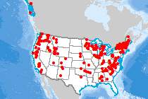
Watersheds (HUC8) |
Hydrography |
Geological Survey |
|
|
Abstract:
This data set is a complete digital hydrologic unit boundary layer of the Subbasin (8-digit) 4th level for the entire United States. The Watershed and Subwatershed hydrologic unit boundaries provide a uniquely identified and uniform method of subdividing large drainage areas. The smaller sized 6th level sub-watersheds (up to 250,000 acres) are useful for numerous application programs supported by a variety of local, State, and Federal Agencies. This data set is intended to be used as a tool for water-resource management and planning activities, particularly for site-specific and localized studies requiring a level of detail provided by large-scale map information.
Metadata File
Publication Date: March 2023 -
Data last updated: 2023-11-28
|
|
 |
Water Body |
Hydrography |
Geological Survey |
|
|
Abstract:
Depicts water bodies (e.g. lakes and ponds) from the U.S. Geological Survey NHDPlus High Resolution data, with VISIBILITYFILTER >= 50000.
Metadata File
Publication Date: July 2022 -
Data last updated: 2024-02-06
|
|
 |
HydroKinetic Project |
Hydrography |
Federal Energy Regulatory Commission |
|
|
Abstract:
Hydrokinetic Projects with Licenses and Preliminary Permits
Metadata File
Publication Date: December 2016 -
Data last updated: 2017-01-06
|
|
 |
Pumped Storage Site |
Hydrography |
Sandia National Laboratories |
Storage |
|
Abstract:
Depicts pumped storage facility locations throughout the United States.
Metadata File
Publication Date: October 2016 -
Data last updated: 2016-11-22
|
|
 |
Tidal - Mean Kinetic Power Density |
Hydrography |
Georgia Institute of Technology - Savannah |
Water |
|
Abstract:
This layer displays the mean kinetic power density for tidal streams in the United States.
Metadata File
Publication Date: May 2011 -
Data last updated: 2016-10-11
|
|
 |
Water Use - Change in Consumption (All Sources) |
Hydrography |
Sandia National Laboratories |
|
|
Abstract:
This layer depicts estimated current and future consumptive water use, and supply/cost for fresh surface water, fresh groundwater, brackish groundwater and municipal wastewater, all at the 8-digit hydrologic unit level (HUC8).
Metadata File
Publication Date: September 2016 -
Data last updated: 2022-06-08
|
|
 |
Water Availability - Fresh Groundwater |
Hydrography |
Sandia National Laboratories |
|
|
Abstract:
This layer depicts estimated current and future consumptive water use, and supply/cost for fresh surface water, fresh groundwater, brackish groundwater and municipal wastewater, all at the 8-digit hydrologic unit level (HUC8).
Metadata File
Publication Date: September 2016 -
Data last updated: 2022-06-08
|
|
 |
Pumped Storage Issued Preliminary Permit |
Hydrography |
Federal Energy Regulatory Commission |
Storage |
|
Abstract:
Issued preliminary permits for pumped storage projects by the Federal Energy Regulatory Commission. Preliminary permits are issued for up to three years, and do not authorize construction; rather, it maintains priority of application for a license (i.e., guaranteed first-to-file status) while the permittee studies the site and prepares to apply for a license. The permittee must submit periodic reports on the status of its studies. It is not necessary to obtain a permit in order to apply for or receive a license.
Metadata File
Publication Date: November 2011 -
Data last updated: 2011-11-14
|
|
 |
Water Availability - Municipal Wastewater |
Hydrography |
Sandia National Laboratories |
|
|
Abstract:
This layer depicts estimated current and future consumptive water use, and supply/cost for fresh surface water, fresh groundwater, brackish groundwater and municipal wastewater, all at the 8-digit hydrologic unit level (HUC8).
Metadata File
Publication Date: September 2016 -
Data last updated: 2022-06-08
|
|
 |
Aquifer Area |
Hydrography |
Geological Survey |
|
|
Abstract:
This dataset represents the shallowest principal aquifers of the conterminous United States, Hawaii, Puerto Rico, and the U.S. Virgin Islands.
Metadata File
Publication Date: October 2003 -
Data last updated: 2021-08-26
|
|
 |
Coastal Barrier Resources System |
Hydrography |
Fish and Wildlife Service |
|
|
Abstract:
This layer displays the aerial extent of the boundaries of the John H. Chafee Coastal Barrier Resources System.
Metadata File
Publication Date: May 2015 -
Data last updated: 2015-07-21
|
|
 |
Water Availability - Appropriated Surface Water |
Hydrography |
Sandia National Laboratories |
|
|
Abstract:
This layer depicts estimated current and future consumptive water use, and supply/cost for fresh surface water, fresh groundwater, brackish groundwater and municipal wastewater, all at the 8-digit hydrologic unit level (HUC8).
Metadata File
Publication Date: September 2016 -
Data last updated: 2022-06-08
|
|
 |
Hydro Run of River Min Monthly Generation (1970 - 2015, September) |
Hydrography |
Argonne National Laboratory |
Water |
|
Abstract:
Depicts run-of-river (ROR) hydroelectric power plant sites in the U.S., attributed with descriptive information, and minimum and maximum power generation by month of year between 1970 and 2015. Symbolization shows the minimum monthly generation occurring between 1970 and 2015 in the month of September, which is the month with the lowest overall generation.
Metadata File
Publication Date: December 2016 -
Data last updated: 2016-12-22
|
|
 |
Watersheds (HUC2) |
Hydrography |
Geological Survey |
|
|
Abstract:
Depicts Level 2 hydrologic units.
Metadata File
Publication Date: March 2023 -
Data last updated: 2023-11-28
|
|
 |
Tidal - Mean Current Speed |
Hydrography |
Georgia Institute of Technology - Savannah |
Water |
|
Abstract:
This layer displays the mean current speed for tidal streams in the United States.
Metadata File
Publication Date: May 2011 -
Data last updated: 2016-10-11
|


