|
Thumbnail |
Title |
Category |
Data Source |
Resource |
|
 |
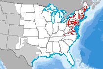
City Boundaries |
Boundary |
Census Bureau |
|
|
Abstract:
Depicts city boundaries from the U.S. Census Bureau. A consolidated city is a unit of local government for which the functions of an incorporated place and its county or minor civil division (MCD) have merged.
Metadata File
Publication Date: January 2023 -
Data last updated: 2024-01-24
|
|
 |
Urban Area |
Boundary |
Census Bureau |
|
|
Abstract:
U.S. Census Urbanized Areas represent areas of high population density and urban land use resulting in a representation of the "urban footprint." There are two types of urban areas: urbanized areas (UAs) that contain 50,000 or more people and urban clusters (UCs) that contain at least 2,500 people, but fewer than 50,000 people (except in the U.S. Virgin Islands and Guam which each contain urban clusters with populations greater than 50,000). Each urban area is identified by a 5-character numeric census code that may contain leading zeroes.
Metadata File
Publication Date: January 2023 -
Data last updated: 2024-01-17
|
|
 |
Alaska Native Regional Corporation Boundaries |
Cadastre |
Census Bureau |
|
|
Abstract:
Depicts Alaska Native regional corporation boundaries.
Metadata File
Publication Date: August 2022 -
Data last updated: 2023-11-10
|
|
 |
Tribal Reservation |
Cadastre |
Census Bureau |
|
|
Abstract:
The American Indian / Alaska Native / Native Hawaiian (AIANNH) Areas Shapefile includes the following legal entities: federally recognized American Indian reservations and off-reservation trust land areas, State- recognized American Indian reservations, and Hawaiian home lands (HHLs). The statistical entities included are Alaska Native village statistical areas (ANVSAs), Oklahoma tribal statistical areas (OTSAs), tribal designated statistical areas (TDSAs), and State designated tribal statistical areas (SDTSAs). Joint use areas are also included in this shapefile and mean that the area is administered jointly and/or claimed by two or more American Indian tribes.
Metadata File
Publication Date: August 2022 -
Data last updated: 2023-11-10
|
|
 |
Census Tract |
Demographics |
Census Bureau |
|
|
Abstract:
This data displays the United States Census Tracts along with population figures from the 2010 Census.
Metadata File
Publication Date: 2010 -
Data last updated: 2019-01-17
|
|
 |
Housing - Mobile Home Units/sq. mi. |
Demographics |
Census Bureau - American Community Survey |
|
|
Abstract:
Block-group-level estimates multi-unit housing and mobile home statistics, including rented/owned statistics for the U.S. based on the 2018 American Community Survey (5- Year) data.
Metadata File
Publication Date: January 2018 -
Data last updated: 2021-07-26
|
|
 |
Block Groups: Total Minority |
Demographics |
Census Bureau - American Community Survey |
|
|
Abstract:
Depicts U.S. Census Block Groups with low income and minority statistics from the 2018 American Community Survey (5-Year). Standard environmental justice metrics were computed by Argonne National Laboratory, including percent low income, percent total minority and single race/ethnicity categories, and each percentage minus 20% over the state average of each category.
Metadata File
Publication Date: January 2018 -
Data last updated: 2021-02-23
|
|
 |
Block Groups: Population Density |
Demographics |
Census Bureau - American Community Survey |
|
|
Abstract:
U.S. Census Block Group Population per Square Mile, based on 2018 5-Year American Community Survey estimates.
Metadata File
Publication Date: January 2018 -
Data last updated: 2021-06-07
|
|
 |
Block Groups: Low Income |
Demographics |
Census Bureau - American Community Survey |
|
|
Abstract:
Depicts U.S. Census Block Groups with low income and minority statistics from the 2018 American Community Survey (5-Year). Standard environmental justice metrics were computed by Argonne National Laboratory, including percent low income, percent total minority and single race/ethnicity categories, and each percentage minus 20% over the state average of each category.
Metadata File
Publication Date: January 2018 -
Data last updated: 2021-02-23
|
|
 |
Households without Vehicles |
Demographics |
Census Bureau - American Community Survey |
|
|
Abstract:
Depicts household without vehicle statistics by census tract, including rented/owned statistics, for the U.S.
based on the 2019 American Community Survey (5-Year) data.
Metadata File
Publication Date: January 2019 -
Data last updated: 2021-10-08
|
|
 |
Housing - Units in Large Multi-unit Structures/sq. mi |
Demographics |
Census Bureau - American Community Survey |
|
|
Abstract:
Block-group-level estimates multi-unit housing and mobile home statistics, including rented/owned statistics for the U.S. based on the 2018 American Community Survey (5- Year) data.
Metadata File
Publication Date: January 2018 -
Data last updated: 2021-07-26
|
|
 |
River Temperature Model (NE) |
Climate |
City University of New York |
|
|
Abstract:
This dataset depicts modeling results from the Water Balance Model-Thermoelectric Power & Thermal Pollution Model (WBM-TP2M) for the northeast U.S. Together, these models incorporate climate, hydrology, river network dynamics and multi-plant impacts to quantify the following on a per power plant basis and at a regional scale:
• Thermal pollution
• Electricity generation
• Water withdrawal and consumption
• River temperatures and discharge
• Power plant efficiency losses associated with changes in available cooling water and climate conditions
Results here show monthly average temperature changes due to power plant thermal effluents for years 2000 – 2010 Rivers shown have a modeled average summertime discharge of 5 cubic meters/second and higher for the years 2000 – 2010. Temperature changes are given in degrees Celsius and results were computed at a daily time steps and a 5 km cell spatial resolution.
Metadata File
Publication Date: July 2015 -
Data last updated: 2015-09-02
|
|
 |
Clean Cities Coalition Boundaries |
Transportation |
Clean Cities |
|
|
Abstract:
Depicts Clean City Coalition Boundaries
Metadata File
Publication Date: November 2023 -
Data last updated: 2023-11-10
|
|
 |
Landscape Permeability Flow Model |
Ecology |
Colorado State University |
|
|
Abstract:
This layer displays where roads and energy corridors impact the surrounding wildlife.
Metadata File
Publication Date: September 2013 -
Data last updated: 2014-05-13
|
|
 |
Airport Surveillance Radar (ASR) |
Communications |
Compiled from multiple sources |
|
|
Abstract:
This data displays the location of the Airport Surveillance Radar System (ASR) throughout the United States and United States Territories.
Metadata File
Publication Date: May 2012 -
Data last updated: 2014-11-06
|


