|
Thumbnail |
Title |
Category |
Data Source |
Resource |
|
 |
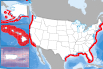
Solar Potential: 1-Axis Tracking Flat-Plate Collector |
Climate |
National Renewable Energy Laboratory; et al |
Solar |
|
Abstract:
Solar resource potential for the 48 contiguous states. The insolation values represent the average solar energy available to a concentrating collector on a 1-axis tracker, such as a dish or a power tower.
Metadata File
Publication Date: March 2007 -
Data last updated: 2019-01-29
|
|
 |
Wave Energy - Hindcast Direction |
Hydrography |
National Renewable Energy Laboratory; et al |
|
|
Abstract:
This data represents Wave Hindcast Direction.
Metadata File
Publication Date: October 2011 -
Data last updated: 2021-10-26
|
|
 |
Solar Potential: Tilted Photovoltaic (PV) |
Climate |
National Renewable Energy Laboratory; et al |
Solar |
|
Abstract:
Solar resource potential for the 48 contiguous states. The insolation values represent the average solar energy available to a flat plate collector, such as a photovoltaic panel, oriented due south at an angle from horizontal equal to the latitude of the collector location.
Metadata File
Publication Date: September 2012 -
Data last updated: 2018-08-15
|
|
 |
Potential Wind Capacity - 110-m (Near-Future) |
Climate |
National Renewable Energy Laboratory |
|
|
Abstract:
110-Meter Hub Height (Near Future) Potential Wind Capacity.
Metadata File
Publication Date: May 2015 -
Data last updated: 2018-08-15
|
|
 |
Potential Wind Capacity - 80-m (Current) |
Climate |
National Renewable Energy Laboratory |
|
|
Abstract:
80-Meter Hub Height (Current) Potential Wind Capacity
Metadata File
Publication Date: May 2015 -
Data last updated: 2018-08-15
|
|
 |
Potential Wind Capacity - 110-m (Current) |
Climate |
National Renewable Energy Laboratory |
|
|
Abstract:
These data represent the land area with a gross capacity factor (GCF) of 35% and greater.
Metadata File
Publication Date: May 2015 -
Data last updated: 2018-08-15
|
|
 |
Potential Wind Capacity - 140-m (Current) |
Climate |
National Renewable Energy Laboratory |
|
|
Abstract:
140-Meter Hub Height (Current) Potential Wind Capacity
Metadata File
Publication Date: May 2015 -
Data last updated: 2018-08-15
|
|
 |
Potential Wind Capacity - 140-m (Near-Future) |
Climate |
National Renewable Energy Laboratory |
|
|
Abstract:
140-Meter Hub Height (Near Future) Potential Wind Capacity
Metadata File
Publication Date: May 2015 -
Data last updated: 2018-08-15
|
|
 |
Enhanced Geothermal System (EGS) Technology Potential |
Geology |
National Renewable Energy Laboratory |
|
|
Abstract:
This dataset reflects power density estimate at optimum LCOE between 3.5 and 9.5 km. Levelized Cost of Electricity (LCOE) was calculated for Temperature at Depth (TAD) data, which was produced by the Southern Methodist University (SMU) geothermal program. TAD data for the lower 48 United States, which estimated temperature at depth from 3.5 km to 9.5 km in 1 km intervals.
Metadata File
Data last updated: 2017-01-19
|
|
 |
Potential Wind Capacity - 80-m (Near-Future) |
Climate |
National Renewable Energy Laboratory |
|
|
Abstract:
80-Meter Hub Height (Near Future) Potential Wind Capacity
Metadata File
Publication Date: May 2015 -
Data last updated: 2018-08-15
|
|
 |
Ridgeline Area |
Landform |
National Renewable Energy Laboratory |
|
|
Abstract:
This data, developed at the National Renewable Energy Laboratory, represents ridgelines across the United States at a 1km spatial resolution.
Metadata File
Data last updated: 2016-03-22
|
|
 |
Enhanced Geothermal System (EGS) Potential |
Geology |
National Renewable Energy Laboratory |
|
|
Abstract:
This dataset is a qualitative assessment of geothermal potential (Enhanced Geothermal System EGS) for the US based on Levelized Cost of Electricity, with CLASS 1 being most favorable, and CLASS 5 being least favorable. This dataset does not include shallow EGS resources located near hydrothermal sites or USGS assessment of undiscovered hydrothermal resources.
Metadata File
Publication Date: 2009 -
Data last updated: 2022-06-13
|
|
 |
Estimated Temperature at 2000 m Depth |
Geology |
National Renewable Energy Laboratory |
|
|
Abstract:
Estimated temperature at 2000 m Depth
Metadata File
Publication Date: 2016 -
Data last updated: 2021-07-22
|
|
 |
Geopressure Energy Potential - Plan 2 |
Geology |
National Renewable Energy Laboratory |
Geothermal |
|
Abstract:
Plan 2 - Geopressurized resource data from USGS 1978 Circular, "Assessment of Geothermal Resources of the United States." Layer represents producible energy over 30 years in MWe/km^2 with a 2.6% recovery factor from total thermal energy.
Metadata File
Publication Date: 1978 -
Data last updated: 2012-08-11
|
|
 |
Geopressure Energy Potential - Plan 3 |
Geology |
National Renewable Energy Laboratory |
Geothermal |
|
Abstract:
Plan 3 - Geopressurized resource data from USGS 1978 Circular, "Assessment of Geothermal Resources of the United States." Layer represents producible energy over 30 years in MWe/km^2 with a 0.25% recovery factor from total thermal energy.
Metadata File
Publication Date: 1978 -
Data last updated: 2012-08-11
|


