|
Thumbnail |
Title |
Category |
Data Source |
Resource |
|
 |
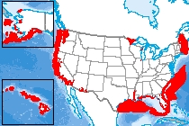
Cooling Degree Days - Lower Emissions (2070-2099) |
Climate |
National Oceanic and Atmospheric Administration; et al. |
|
|
Abstract:
This raster dataset displays the average of cooling degree days projections from several climate models for the lower emissions (B1) scenario, for the period of 2070-2099, relative to 1971-1999. Cooling degree days are defined as the number of degrees that a day’s average temperature is above 65ºF.
Metadata File
Publication Date: November 2013 -
Data last updated: 2015-03-23
|
|
 |
Tethered Aerostat Radar System (TARS) |
Communications |
National Oceanic and Atmospheric Administration; et al. |
|
|
Abstract:
This data displays the location of the Tethered Aerostat Radar System (TARS) throughout the United States and overseas.
Metadata File
Publication Date: January 2012 -
Data last updated: 2014-11-06
|
|
 |
Cooling Degree Days - Higher Emissions (2070-2099) |
Climate |
National Oceanic and Atmospheric Administration; et al. |
|
|
Abstract:
This raster dataset displays the average of cooling degree days projections from several climate models for the higher emissions (A2) scenario, for the period of 2070-2099, relative to 1971-1999. Cooling degree days are defined as the number of degrees that a day’s average temperature is above 65ºF.
Metadata File
Publication Date: November 2013 -
Data last updated: 2015-03-23
|
|
 |
Cooling Degree Days - Lower Emissions (2021-2050) |
Climate |
National Oceanic and Atmospheric Administration; et al. |
|
|
Abstract:
This raster dataset displays the average of cooling degree days projections from several climate models for the lower emissions (B1) scenario, for the period of 2021-2050, relative to 1971-1999. Cooling degree days are defined as the number of degrees that a day’s average temperature is above 65ºF.
Metadata File
Publication Date: November 2013 -
Data last updated: 2015-03-23
|
|
 |
Artificial Reef |
Ecology |
National Oceanic and Atmospheric Administration |
|
|
Abstract:
This layer displays artificial reefs, which are human-made underwater structure, typically built to promote marine life in areas with a generally featureless bottom, control erosion, block ship passage, or improve surfing.
Metadata File
Publication Date: December 2015 -
Data last updated: 2017-01-03
|
|
 |
Bathymetry DEM with Great Lakes |
Landform |
National Oceanic and Atmospheric Administration |
|
|
Abstract:
This layer displays NOAA bathymetry data for coastal regions of the Atlantic Ocean, Gulf of Mexico, and Great Lakes.
Metadata File
Data last updated: 2013-02-28
|
|
 |
Unexploded Ordnance (Offshore) |
Environmental Hazards |
National Oceanic and Atmospheric Administration |
|
|
Abstract:
Depicts unexploded ordnance that did not explode when they were employed and still pose a risk of detonation, potentially many decades after they were used or discarded.
Metadata File
Publication Date: February 2017 -
Data last updated: 2019-01-29
|
|
 |
Anchorage Area |
Transportation |
National Oceanic and Atmospheric Administration |
|
|
Abstract:
This layer depicts Anchorage Areas in the United States as designated by the United States Coast Guard.
Metadata File
Publication Date: May 2015 -
Data last updated: 2017-01-03
|
|
 |
Marine Wreck/Obstruction |
Transportation |
National Oceanic and Atmospheric Administration |
|
|
Abstract:
Depicts information on wrecks and obstructions, and other significant charted features in coastal waters of the United States subject to National Ocean Service (NOS) hydrographic surveys.
Metadata File
Publication Date: April 2014 -
Data last updated: 2017-01-05
|
|
 |
Navigational Aid - Marine |
Transportation |
National Oceanic and Atmospheric Administration |
|
|
Abstract:
Depicts marine structures intended to assist a navigator to determine position, safe course, or to warn of dangers or obstructions to navigation. This data set includes lights, signals, buoys, day beacons, and other aids to navigation.
Metadata File
Publication Date: August 2017 -
Data last updated: 2019-01-30
|
|
 |
Danger Zones and Restricted Areas |
Environmental Hazards |
National Oceanic and Atmospheric Administration |
|
|
Abstract:
These data represent the location of Danger Zones and Restricted Areas within coastal and marine waters, as outlined by the Code of Federal Regulations (CFR) and the Raster Navigational Charts (RNC).
Metadata File
Publication Date: July 2015 -
Data last updated: 2017-01-06
|
|
 |
Marine Sanctuary |
Land Status |
National Oceanic and Atmospheric Administration |
|
|
Abstract:
These GIS compatible digital files are provided to promote an understanding of the boundaries of each national marine sanctuary. They are based on the legal definition of each sanctuary as defined in the Code of Federal Regulations, at 15 C.F.R. Part 922 and the subparts for each national marine sanctuary.
Metadata File
Publication Date: 2017 -
Data last updated: 2017-01-16
|
|
 |
High Frequency Radar Locations |
Communications |
National Oceanic and Atmospheric Administration |
|
|
Abstract:
This dataset show the point locations of High Frequency (HF) radar systems across the US.
Metadata File
Publication Date: February 2016 -
Data last updated: 2017-01-06
|
|
 |
Coastal Critical Habitat |
Ecology |
National Oceanic and Atmospheric Administration |
|
|
Abstract:
This dataset is a compilation of the NOAA National Marine Fisheries Service and the U.S. Fish & Wildlife Service ESA listed species in coastal areas.
Metadata File
Data last updated: 2018-08-15
|
|
 |
Submarine Cable |
Utilities |
National Oceanic and Atmospheric Administration |
|
|
Abstract:
Depicts the location of submarine cables as defined by the NOAA Electronic Navigation Charts and the NOAA Raster Nautical Charts.
Metadata File
Publication Date: July 2016 -
Data last updated: 2017-01-03
|


