|
Thumbnail |
Title |
Category |
Data Source |
Resource |
|
 |
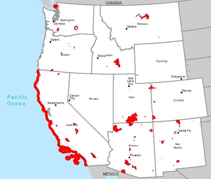
National Trail |
Land Status |
Argonne National Laboratory; et al. |
|
|
Abstract:
Depicts National Scenic and Historic Trails. The data have been collected from the National Park Service, United States Forest Service, Universities, and Private Organizations that oversee various trails.
Metadata File
Publication Date: November 2017 -
Data last updated: 2019-01-30
|
|
 |
National Scenic Trail |
Land Status |
National Park Service |
|
|
Abstract:
National Scenic Trails in the United States. The data used to create this map is a representation of the trails and in many cases an approximation and may not represent the exact location of the trails. National Scenic Trials shown represent physical hiking trails, however many sections may still be in the design or planning stage and not yet complete. Always consult the official source for the most up-to-date information.
Metadata File
Publication Date: April 2019 -
Data last updated: 2019-09-19
|
|
 |
National Park Service Boundary |
Boundary |
National Park Service |
|
|
Abstract:
Depicts National Park Service tract and boundary data to identify the ownership of the lands within the authorized boundaries of the park unit.
Metadata File
Publication Date: January 2024 -
Data last updated: 2024-01-23
|
|
 |
National Offshore Wind Resource Assessment (90m) |
Climate |
National Renewable Energy Laboratory; et al. |
Wind |
|
Abstract:
Annual average offshore wind speed for the Atlantic Coast (Connecticut, Delaware, Georgia, Massachusetts, Maine, Maryland, New Hampshire, New Jersey, New York, North Carolina, Rhode Island, South Carolina, and Virginia) at a 90 meter height. Annual average offshore wind speed for the Great Lakes (Indiana, Illinois, Michigan, Minnesota, New York, Ohio, Pennsylvania, and Wisconsin) at a 90 meter height. Annual average offshore wind speed for the western Gulf of Mexico (Texas and Louisiana) at a 90 meter height.
Metadata File
Publication Date: September 2009 -
Data last updated: 2011-07-11
|
|
 |
National Monument |
Land Status |
Argonne National Laboratory |
|
|
Abstract:
This dataset was compiled for use as a complete set of the National Monuments administered by all federal agencies of the U.S.
Metadata File
Publication Date: 2014 -
Data last updated: 2015-08-14
|
|
 |
National Land Cover Database - Lower 48 States |
Land Status |
Geological Survey |
|
|
Abstract:
Depicts the National Land Cover Database (NLCD) 2021 Land Cover Conterminous United States from the U.S. Geological Survey.
Metadata File
Publication Date: June 2023 -
Data last updated: 2024-01-26
|
|
 |
National Land Cover Database - Alaska |
Land Status |
Geological Survey |
|
|
Abstract:
Depicts the National Land Cover Database (NLCD) 2016 Land Cover - Alaska (ver. 2.0, July 2020) from the U.S. Geological Survey.
Metadata File
Publication Date: July 2020 -
Data last updated: 2024-01-26
|
|
 |
National Historic Trails |
Land Status |
National Park Service |
|
|
Abstract:
National Historic Trails in the United States. The data used to create this map is a representation of the trails and in many cases an approximation and may not represent the exact location of the trails. National Historic Trails shown represent Congressionally-designated routes associated with historic trails; they are not fully developed hiking trails and may not represent physical trails. Always consult the official source for the most up-to-date information.
Metadata File
Publication Date: November 2023 -
Data last updated: 2023-11-28
|
|
 |
National Historic Landmark Points |
Land Status |
National Park Service |
|
|
Abstract:
Depicts designated National Historic Landmark points.
Metadata File
Publication Date: July 2023 -
Data last updated: 2024-01-05
|
|
 |
National Historic Landmark Area |
Land Status |
National Park Service |
|
|
Abstract:
Depicts designated National Historic Landmark areas.
Metadata File
Publication Date: July 2023 -
Data last updated: 2024-01-05
|
|
 |
National Conservation Easement Database |
Land Status |
Ducks Unlimited |
|
|
Abstract:
This layer displays conservation easement records from land trusts and public agencies throughout the United States. Conservation easements are legal agreements voluntarily entered into between landowners and conservation entities (agencies or land trusts) for the express purpose of protecting certain societal values such as open space or vital wildlife habitats.
Metadata File
Publication Date: March 2023 -
Data last updated: 2024-01-16
|
|
 |
National Conservation Areas |
Land Status |
Bureau of Land Management |
|
|
Abstract:
Depicts designated National Conservation Areas administered by the Bureau of Land Management.
Metadata File
Publication Date: January 2024 -
Data last updated: 2024-01-31
|
|
 |
NHESP BioMap2 Critical Natural Landscape |
Ecology |
MA Division of Fisheries and Wildlife; et al. |
|
|
Abstract:
This layer identifies the large, natural Landscape Blocks in Massachusetts.
Metadata File
Publication Date: 2010 -
Data last updated: 2012-06-08
|
|
 |
NHESP BioMap2 Core Habitat |
Ecology |
MA Division of Fisheries and Wildlife; et al. |
|
|
Abstract:
This layer displays lands important to the protection of: Habitats for rare, vulnerable, or uncommon vertebrate, invertebrate, and plants species; Priority natural communities; High-quality wetland, vernal pool, aquatic, and coastal habitats; and intact forest ecosystems in Massachusetts.
Metadata File
Publication Date: 2010 -
Data last updated: 2012-06-08
|
|
 |
NERC Subregions |
Boundary |
Oak Ridge National Laboratory; et al. |
|
|
Abstract:
Depicts North American Electric Reliability Corporation (NERC) subregions
Metadata File
Publication Date: June 2018 -
Data last updated: 2019-01-29
|


