|
Thumbnail |
Title |
Category |
Data Source |
Resource |
|
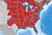 |
Aquifer Water Stress Projections |
Climate |
World Resources Institute |
|
|
Abstract:
This layer depicts change indicators for water supply, water demand (withdrawal and comsumptive use), water stress (the ratio of water withdrawal to supply), and seasonal variability, projected for future decades under scenarios of climate and economic growth. Time periods are centered on 2020, 2030, and 2040 for each of two climate scenarios, (RCP4.5 and RCP8.5) and two shared socioeconomic pathways, (SSP2 and SSP3).
Metadata File
Publication Date: April 2015 -
Data last updated: 2015-06-30
|
|
 |
Aquifer Water Risk |
Hydrography |
World Resources Institute |
|
|
Abstract:
This layer depicts aquifer water risk (called aqueduct water risk by the authors) results from the World Resources Institute, including water withdrawals, (total amount of water abstracted from freshwater sources for human use) consumptive use (the portion of water that evaporates or is incorporated into a product), and water supply (total blue water from natural water discharge, and available blue water which accounts for withdrawals and consumptive use).
Metadata File
Publication Date: January 2013 -
Data last updated: 2015-06-30
|
|
 |
Aquifer Area |
Hydrography |
Geological Survey |
|
|
Abstract:
This dataset represents the shallowest principal aquifers of the conterminous United States, Hawaii, Puerto Rico, and the U.S. Virgin Islands.
Metadata File
Publication Date: October 2003 -
Data last updated: 2021-08-26
|
|
 |
Aquatic Priority Conservation Area (AL) |
Ecology |
AL Department of Conservation and Natural Resources |
|
|
Abstract:
This layer displays Priority Areas for conservation of aquatic Greatest Conservation Need (GCN) species in Alabama.
Metadata File
Publication Date: October 2008 -
Data last updated: 2011-09-19
|
|
 |
Aquatic Priority Area (TN) |
Ecology |
TN Wildlife Resources Agency |
|
|
Abstract:
Displays the aquatic priority area portion of the State Wildlife Action Plan Priority Habitat in Tennessee.
Metadata File
Publication Date: 2005 -
Data last updated: 2011-09-21
|
|
 |
Aquatic Conservation Focus Area (MT) |
Ecology |
MT Department of Fish, Wildlife, and Parks |
|
|
Abstract:
Montana Fish, Wildlife, and Parks Comprehensive Fish and Wildlife Conservation Strategy-Tier One Aquatic Focus Areas.
Metadata File
Publication Date: January 2006 -
Data last updated: 2011-09-21
|
|
 |
Appalachian Foothills Focus Area (OH) |
Ecology |
OH Department of Natural Resources - Division of Wildlife |
|
|
Abstract:
This layer displays areas in the Appalachian Foothills Forestland that can support forest habitats in a conservation effort aimed at abundant species and those that are at risk.
Metadata File
Data last updated: 2011-09-21
|
|
 |
Anchorage Area |
Transportation |
National Oceanic and Atmospheric Administration |
|
|
Abstract:
This layer depicts Anchorage Areas in the United States as designated by the United States Coast Guard.
Metadata File
Publication Date: May 2015 -
Data last updated: 2017-01-03
|
|
 |
Alternative Fuel Station - LPG |
Transportation |
Alternative Fuels Data Center |
|
|
Abstract:
Depicts LPG fueling facilities in the United States.
Metadata File
Publication Date: November 2023 -
Data last updated: 2023-11-10
|
|
 |
Alternative Fuel Station - Hydrogen |
Transportation |
Alternative Fuels Data Center |
|
|
Abstract:
Depicts hydrogen fueling facilities in the United States.
Metadata File
Publication Date: November 2023 -
Data last updated: 2023-11-10
|
|
 |
Alternative Fuel Station - CNG |
Transportation |
Alternative Fuels Data Center |
|
|
Abstract:
Depicts CNG fueling facilities in the United States.
Metadata File
Publication Date: November 2023 -
Data last updated: 2023-11-10
|
|
 |
Alternative Fuel Station - All Types |
Transportation |
Alternative Fuels Data Center |
|
|
Abstract:
Depicts fueling facilities that offer fuels other than gasoline in the United States.
Metadata File
Publication Date: November 2023 -
Data last updated: 2023-11-10
|
|
 |
Alaska Native Regional Corporation Boundaries |
Cadastre |
Census Bureau |
|
|
Abstract:
Depicts Alaska Native regional corporation boundaries.
Metadata File
Publication Date: August 2022 -
Data last updated: 2023-11-10
|
|
 |
Airport Surveillance Radar (ASR) |
Communications |
Compiled from multiple sources |
|
|
Abstract:
This data displays the location of the Airport Surveillance Radar System (ASR) throughout the United States and United States Territories.
Metadata File
Publication Date: May 2012 -
Data last updated: 2014-11-06
|
|
 |
Airport Runways |
Transportation |
Federal Aviation Administration |
|
|
Abstract:
Depicts extents of airport runways in the United States.
Metadata File
Publication Date: October 2023 -
Data last updated: 2023-11-30
|


