|
Thumbnail |
Title |
Category |
Data Source |
Resource |
|
 |
Unexploded Ordnance (Offshore) |
Environmental Hazards |
National Oceanic and Atmospheric Administration |
|
|
Abstract:
Depicts unexploded ordnance that did not explode when they were employed and still pose a risk of detonation, potentially many decades after they were used or discarded.
Metadata File
Publication Date: February 2017 -
Data last updated: 2019-01-29
|
|
 |
Under Construction/Unknown Anaerobic Digester |
Environmental Hazards |
Environmental Protection Agency |
|
|
Abstract:
This layer displays the Under Construction/Unknown Anaerobic Digesters in the United States as reported by the U.S. Environmental Protection Agency's AgSTAR Program.
Metadata File
Publication Date: May 2016 -
Data last updated: 2016-09-22
|
|
 |
Conventional Crops 2012 |
Flora |
Bioenergy Knowledge Discovery Framework |
Biomass |
|
Abstract:
This layer displays Conventional Crops for the year 2012 as reported from the Bioenergy Knowledge Discovery Framework.
Metadata File
Publication Date: 2011 -
Data last updated: 2012-03-02
|
|
 |
Secondary Agriculture Residue 2012 |
Flora |
Bioenergy Knowledge Discovery Framework |
Biomass |
|
Abstract:
This layer displays Secondary Agriculture Residue for the year 2012 as reported from the Bioenergy Knowledge Discovery Framework.
Metadata File
Publication Date: 2011 -
Data last updated: 2012-03-02
|
|
 |
Conventional Crops 2022 |
Flora |
Bioenergy Knowledge Discovery Framework |
Biomass |
|
Abstract:
This layer displays Conventional Crops for the year 2022 as reported from the Bioenergy Knowledge Discovery Framework.
Metadata File
Publication Date: 2011 -
Data last updated: 2012-03-02
|
|
 |
Potential Conservation Opportunity Area (GA) |
Flora |
GA Department of Natural Resources |
|
|
Abstract:
This layer displays contiguous patches of natural vegetation that could potentially be conservation opportunity areas in Georgia.
Metadata File
Data last updated: 2011-09-20
|
|
 |
Natural Vegetation (IA) |
Flora |
IA Department of Natural Resources - Wildlife Bureau |
|
|
Abstract:
This layer displays zones of animal and plant life across Iowa that could potentially be conservation opportunity areas.
Metadata File
Data last updated: 2011-09-20
|
|
 |
Quaternary Fault |
Geology |
Geological Survey |
|
|
Abstract:
Depicts faults and associated folds in the that are believed to be sources of M>6 earthquakes during the Quaternary (the past 1,600,000 years).
Metadata File
Publication Date: 2020 -
Data last updated: 2021-12-15
|
|
 |
Saline Formation Suitability |
Geology |
National Energy Technology Laboratory; et al. |
|
|
Abstract:
This layer displays the National Carbon Sequestration Database (NATCARB) of small-scale (large-area) carbon dioxide (CO2) geologic storage potential in saline formations across the USA and parts of Canada.
Metadata File
Publication Date: December 2012 -
Data last updated: 2013-07-29
|
|
 |
Earthquake Intensity |
Geology |
Geological Survey |
|
|
Abstract:
This map layer contains the locations and attributes of significant, historic earthquakes that caused deaths, property damage, and geological effects, or were otherwise experienced by populations in the United States.
Metadata File
Publication Date: July 2010 -
Data last updated: 2011-09-09
|
|
 |
Well Locations (BHT deg. C) |
Geology |
Southern Methodist University |
|
|
Abstract:
Oil and geothermal well locations throughout the United States. Used for geothermal temperature calculations.
Metadata File
Publication Date: September 2008 -
Data last updated: 2011-11-01
|
|
 |
Sediment Texture |
Geology |
Geological Survey |
|
|
Abstract:
Locations of marine sediment samples collected and (or) analyzed by the U.S. Geological Survey, Woods Hole Coastal and Marine Science Center starting in 1955 thru March 2014.
Metadata File
Data last updated: 2017-01-11
|
|
 |
Enhanced Geothermal System (EGS) Technology Potential |
Geology |
National Renewable Energy Laboratory |
|
|
Abstract:
This dataset reflects power density estimate at optimum LCOE between 3.5 and 9.5 km. Levelized Cost of Electricity (LCOE) was calculated for Temperature at Depth (TAD) data, which was produced by the Southern Methodist University (SMU) geothermal program. TAD data for the lower 48 United States, which estimated temperature at depth from 3.5 km to 9.5 km in 1 km intervals.
Metadata File
Data last updated: 2017-01-19
|
|
 |
North American Saline Basin |
Geology |
National Energy Technology Laboratory |
|
|
Abstract:
This dataset provides a single, seamless spatial database of carbon storage potentials for saline formations across the USA and parts of Canada, compiled from regional datasets created by the RCSPs and site characterization projects.
Metadata File
Publication Date: November 2019 -
Data last updated: 2021-10-12
|
|
 |
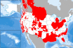
Coal Basins, Region, and Field |
Geology |
Geological Survey |
Coal |
|
Abstract:
This data set shows the coal fields of Alaska and the conterminous United States.
Metadata File
Publication Date: February 2012 -
Data last updated: 2021-09-28
|


